|
|
New Road
Sat. 14th April, 2001
|
 |
|
|
City Road was originally built in 1776, called New Road, to connect the then town of Newcastle at Milk Market to
the neighbouring settlement at North Shields, following the line of the river.
It was extended into the centre and
renamed City Road in 1882 after the town gained City status. The eastern portion past Glasshouse Bridge was renamed Walker Road somewhat earlier.
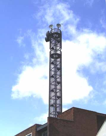
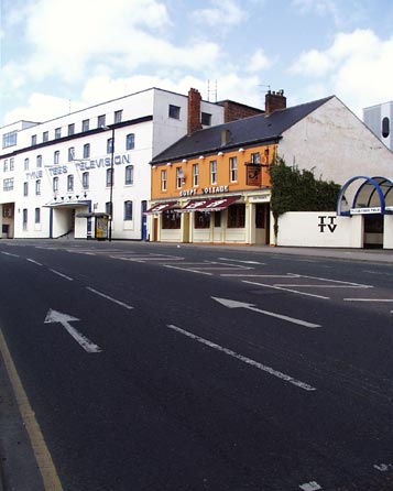
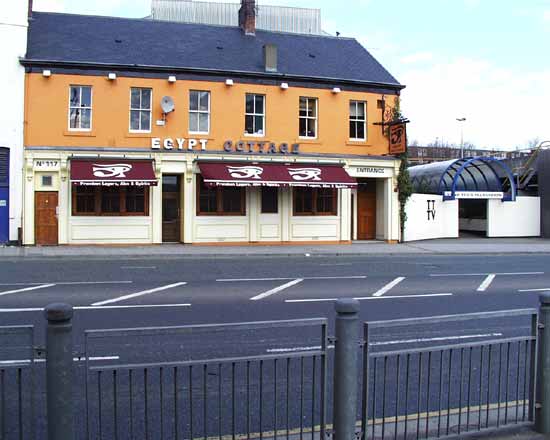
During the 1950s the newly formed Independent
Tyne-Tees Television company took over an old warehouse, itself on the site of an earlier bathhouse, for its studio and transmitter. The company moved to more spacious and expanded premises nearby during the
1960s. The main transmitter is now at Pontop Pike, near Stanley, about 15.5km (9.5mi) from here. Those microwave pods on the tower beam the signal there.
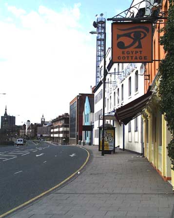
The new premises surround but do not include
the historical Egypt Cottage public house, first appearing on maps in 1840, but occupying the site of an earlier hostelry.
The buildings on the opposite side of the road have all been erected within
the last eight years as part of the Tyne Development Commission renewal of the thin ribbon of land surrounding the river. |
|
|
|
 |
|
|
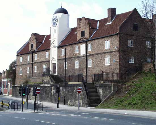
Looking towards the city here, St. Nicholas' Cathedral is visible straight ahead, and All Saints on the Left.
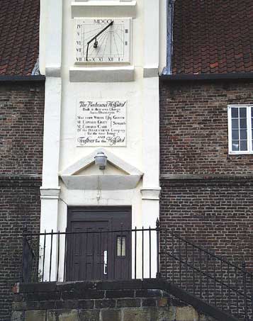
The white tower is the Keelman's Hospital; coming nearer, the Salvation Army residence, on the site of an earlier Lunatic Asylum, then the distinctive white stripes of Claude Gibb Students' residences. Next
is Aerial House, the old home for Tyne Tees TV, and then a much modernised warehouse proclaiming its powder blue edifice, now bereft of its giant street numbers, the subject of a few complaints of bad taste!
|
|
|
 |
|
|
|
|
|
The Keelmen, a fraternity concerned with navigating small coal boats along the Tyne, were first recorded in 1516. In
1639 they established a charity and built the hospital in 1701. In the political climate of the day it was hard for the workers to keep control and the Hostmen Company (coal owners) tried to grab control,
and ultimate ownership for themselves.
The Keelmen set up a fighting fund and benefit society in 1730 and successfully lobbied for a new Act of Parliament in 1788 that kept the robber coal owners at
bay, and provided for the continuance of the hospital. |
|
|
|
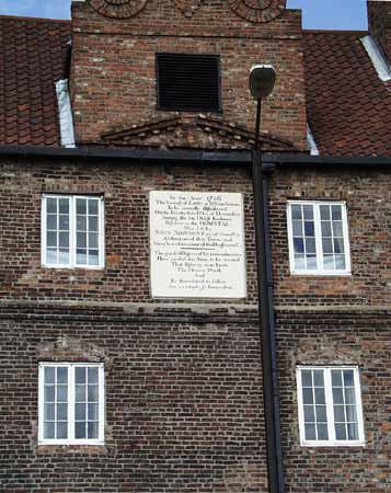
Here an old notice erected on the building states,
"In the year 1786 the interest of £100 at 5% forever to be annually distributed on the 23rd day of December amongst the oldest Keelmen resident in this hospital was
left by John Simpson Esq. of Bradley, Alderman of this town and forty years governor of the Hoastmens Company.
The grateful object of his remembrance have caused this stone to be erected so that
posterity may know the donor's worth and be stimulated to follow an example so benevolent."
A coal owner's attempt to gain
control by their so called benevolence!
Keelmen declined during the 20th century, and this is now student accommodation. |
|
|
|
|
|
|
|
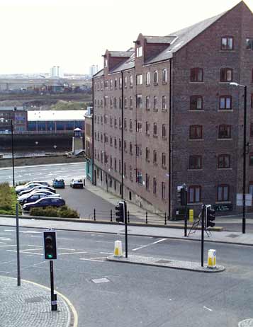
The Milk Market runs from the original end of City Road and the Quayside, running past the end of Sandgate.
The old warehouses have been completely reconstructed as swank dwellings after standing idle for many years and having been put to the torch a few years ago.
The corner site nearest the river is the
Waterline public house, for many years The Tyne, an ordinary alehouse in a fine building. It has now been transformed into an overpriced poseuer's palace.
The new stretch of City Road runs left to
right in the foreground, this junction has been raised and now cuts off the Milk Market below. |
|
 |
|
|
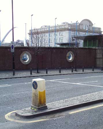
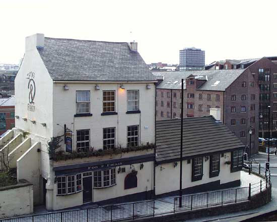
The nearby Fog and Firkin, for many years the Barley Mow, used to be approached by steep steps from the junction
below, but that terrace has been extended during the last improvements and access is gained from City Road or Sandhill via ramps.
To the right here, is the view from the terraced section of City Road
looking over the new Sandhill development, actually a car park roof, to the Co-operative warehouse on the Newcastle side of the river and the curious arch of the new Gateshead Millennium footbridge, yet to
be opened. |
|
|
|
|
|
|
|
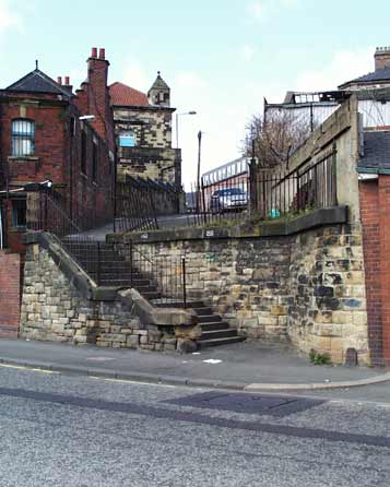
At the city end of City Road are the steps up to Tower Street and the much renovated Sallyport Tower, one of the
remaining strongholds in the town walls.
The upper storey of this tower was built and used by the guild of Carpenters in 1716. the postern gate was often used in times of siege for sallying forth
(rush out from place of defence) to attack the marauding forces.
Those steps and the surrounding walls were constructed from materials from the original wall, its line being along that brick built
factory on the left. |
|
|
|
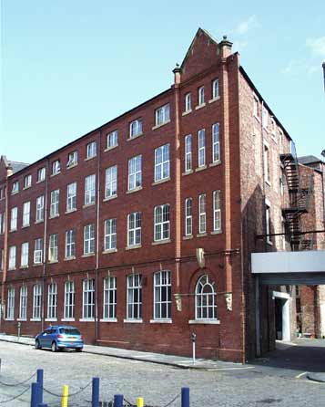
Opposite Sallyport Tower in Tower Street is this magnificent Victorian warehouse. It is now part of the University of
Northumbria and houses students.
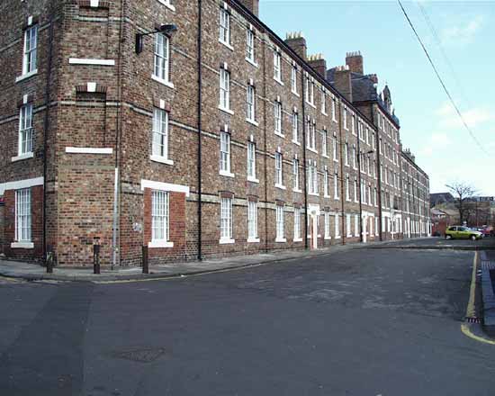
Many buildings in this locality have been put to similar use. Below is the 1878 Industrial Dwellings, built and administered by nearby factory and warehouse owners so
that their workers could be held in their jobs by virtue of the tied accommodation, and so that absenteeism could be reduced. The bosses always knew where the workers lived and it was no great distance to
fetch the reluctant ones.
Victorian benevolence to the working class was never quite what it seemed, and always favoured the bosses! |
|
|
|
|
|
Site and contents (unless otherwise stated) © Tim. Pickford-Jones and Timmonet, Newcastle upon Tyne,
United Kingdom. |
|
|
|
|
 |
|
If you should arrive here via a search, or be missing the navigation on the left hand side, click this button.
|
|