|
|
|
|
Yards
Sat. 31st March., 2001 |
|
|
The 18th century saw a rapid increase in population and businesses in Newcastle.
In common with other walled towns, the very means of defence became a constraint on growth, and in particular growth in economic activity.
If there is
any challenge that mankind hates it is a restraint on its ability to amass greater profits from dynamic trade.
The solution, at least to start with, was to build on unused plots within the town, and
the dawn of the 18th century saw green spaces, often gardens, covered over with stores, houses and workshops.
Part of this intricate honeycomb of courtyards thus created still exists around the Bigg
Market area. The later town planners, Dobson, Clayton and Grainger, left this tranch virtually untouched during their wholesale redesigning of the city centre. |
 |
|
|
|
|
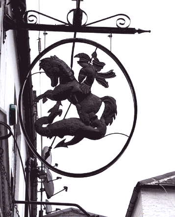
The Bigg Market (Bigg = a type of barley formerly sold here) today is dominated by that large brick edifice that
separates the Cloth Market on the left from the Groat Market to the right. (Groat = oats without husks) Built by the might of an insurance company during the 1970s, it replaced the old Town Hall, built in
1858. This building now sports a massive illuminated television screen, currently advertising Disney films and Swiss watches. |
|
|
|
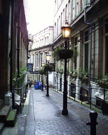
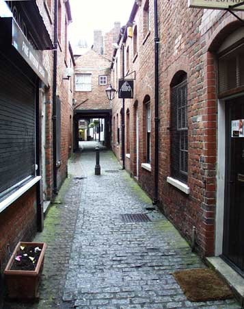
This elegant lane runs from St. John's Church, at the junction of Grainger Street and Westgate Road to the Bigg
Market. Its attractiveness is now enhanced by the cleaning of some of the buildings and the addition of reproduction period lamp standards.
Unlike modern ones, they seem not to be able to detect the
difference between night and day.
There are some popular ale houses here, and Saturday morning is a time for clearing the drunken mess from the night before. The not so gentle scent of stale spilt
beer and disinfectant hangs in the air as the rubbish bins stand replete with the detritus of last nights revelry. |
|
|
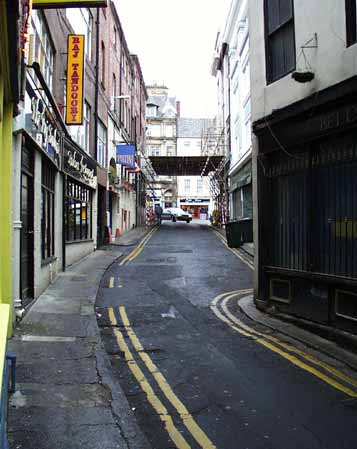
Here is Pudding Chare, named from the Pow Dene, a small river that still runs under the pavement. This little water
course was bridged and eventually buried during the building here.
Pudding Chare runs from the Bigg Market, in the distance in this photo, to Collingwood Street, emerging at Collingwood Buildings. |
|
|
 |
|
|
|
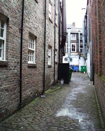
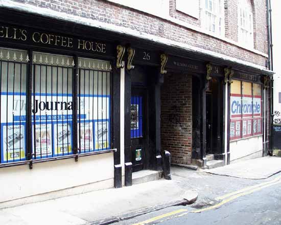
Wilson's Court has an imposing entrance on Pudding Chare, but after going through the arch in what is now expensive
town flats the size broom cupboards, the lane shows its true nature.
Once the fronts of small buildings tacked onto the larger ones, it has long since lapsed into rear access when the larger
businesses absorbed the smaller buildings.
Wilson's Lane has a mediæval feel as the river of foul effluent running down the middle gives off a nasty smell, and rubbish collects in those blue corporate
wheelie bins, from the catering businesses whose tin chimneys belch chip and pizza fumes during opening hours. |
|
|
|
|
|
Here the Cloth Market runs from the Bigg Market to Mosley Street and St. Nicholas Square. That white building in the
distance is to the back of the statue of Queen Victoria, sitting in imperial splendour atop the plague
pit.
The second last white building in this street, with the black entrance lobby is the site of Balmbra's Music Hall, immortalised in the song, "Blaydon Races".
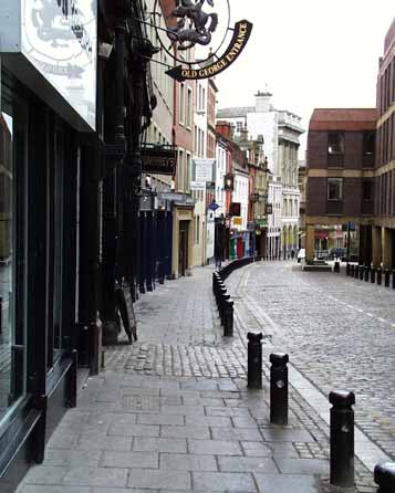
Those cobbles running across
the pavement here signify the entrance to Old George Yard, named from the public house situated there. This lane runs from here via a crooked leg to High Bridge, originally leading to a bridge over the Lort
Burn. This steep sided river, flowing to the Tyne at Sandhill, was filled in during the 1830s by a quarter of a million cart loads of waste and covered by Grey Street and Dean Street.
This entrance to
Old George Yard was for may years flanked by Pumphrey's coffee house. This company, based in Blaydon, imports and roasts distinctive coffee blends. The coffee house was a popular meeting place for business
folk and shoppers, whilst the retail side did a roaring trade in freshly roasted beans. The company now trades by mail-order and has a stall in the Grainger Market. |
|
|
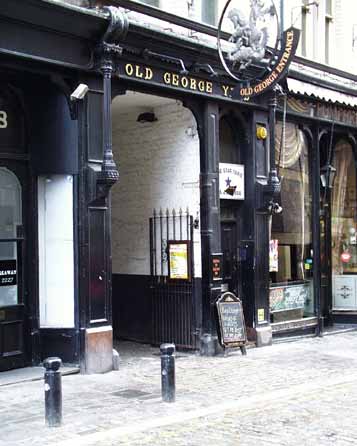
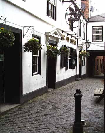
The Old George dates from the 17th century, and since that time has absorbed some adjoining property.
This
lane throngs with party people during summer nights, the cobbled area here and to the right forming a patio for drinkers.
This lane has long since been closed to vehicles, but there is evidence of
carts being used here. They must have been forced to turn at the far end as not even the most athletic horse and elastic cart could negotiate the narrow turn and steps leading to the yard at High Bridge.
|
|
|
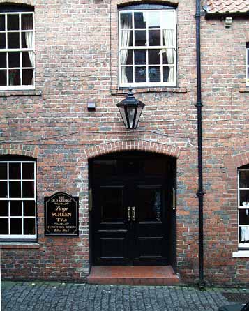
Further along the lane this is an entrance to the Old George annexe, complete with period style lantern.
So
many commercial premises, after cleaning and renovations sprout unsightly electrical boxes and a filigree of cables. It should be possible to route these ugly cables out of sight, and maintain the pleasing
brick relief unsullied. |
|
|
|
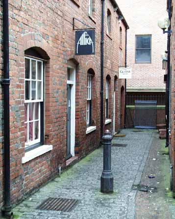
I wonder how much trade really goes on here now. The guitar shop at the end promises to be lively, although it was
just wakening from slumber at 1100hrs, Attica, purveyor of chic bric-a-brac was closed, and the right hand side premises of an interior designer was firmly shut for the weekend.
Those gloriously out
of place bracket lamps speak volumes for the sensitivity you can expect from this firm.
That last arch on the left leads to the stairs down to the yard adjacent to High Bridge.
The cast iron
Victorian Bollard is an excellent example of the simple, functional design of street furniture of the time. Its phallic suggestion is at odds with a society that clothed piano legs so as not to offend the
sensitive sensibilities. The Victorians were masters of hypocrisy.
The press of development eventually became too strong to resist, and the walls having see their last defensive action in 1745, were
largely flattened during the 18th and 19th centuries.
The irresistible march of big business tends to trample on tradition that it sees as an irritant at best and a block to "progress" at worst. It is
good that the City Council and other interested people are now strong enough to preserve our heritage and incorporate it into the modern commercial activity. Long may we have the power to do so. |
|
 |
|
|
|
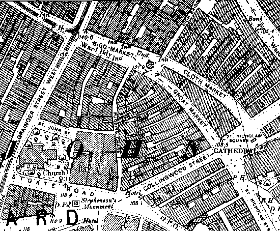
Ordnance Survey Map of 1898, copyright Alan Godfery Maps, Leadgate, Consett, Co. Durham. ©1981 |
|
|
|
Site and contents (unless otherwise stated) © Tim. Pickford-Jones and Timmonet, Newcastle upon Tyne,
United Kingdom. |
|
|
|
|
 |
|
If you should arrive here via a search, or be missing the navigation on the left hand side, click this button.
|
|