|
|
 |
Workers' Village
Sun. 10th Mar., 2002
|
|
|
Elswick (Ells'ik) became part of Newcastle in 1835, before it had been part of the county of Northumberland. The
coal exported from here was the start of the famous Tyneside coal trade.
The district starts at the West Walls and
extends west to Benwell, and north from the river to West Road and the boundary with Fenham and Arthur's Hill.
Here is West View, renamed by the residents after the First World War from its former
unglamorous Gluehouse Lane. The road lead from Elswick Road to the river and the shipyard, passing Elswick Colliery near the junction of Scotswood Road. |
|
|
|
Elswick changed utterly during the late 19th century. The coming of the railway in 1839 followed by Armstrong's
factory in 1847 heralded the beginning of a massive housebuilding spree. The ubiquitous Tyneside flat, where two separate dwellings were combined in a single house were laid out in a gridiron pattern, following the fashion in America. By 1901 and Victoria's death, almost 60,000 people worked at the armament factory.
Armstrong's guns were world renowned. His revolutionary rifled barrels and breech loading mechanism offered previously unknown speed and accuracy.
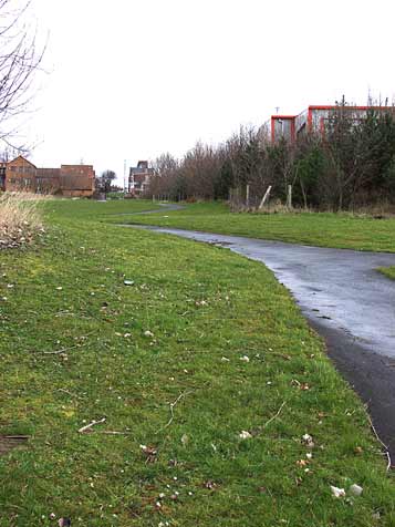
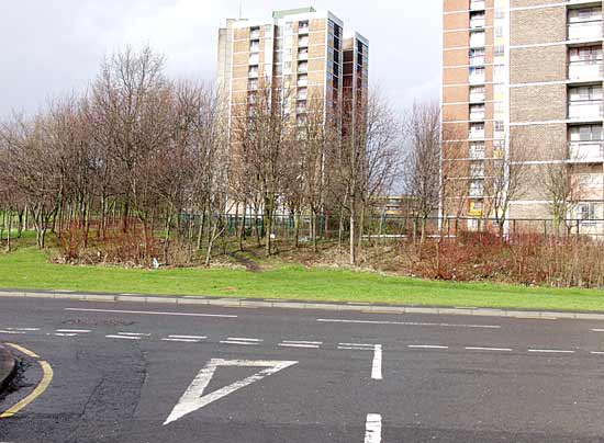
Here at the foot of Gluehouse Lane stood the
colliery, just to the right of that small pathway. The land here is open recreation areas since the clearing of the rows of terraces in the early 1970s. |
|
|
|
|
|
|
|
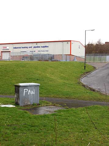
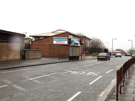
This plumbing warehouse now stands on the site of the colliery, and is skirted by Sanderson Street, reshaped in the
1960s when the now infamous Noble Street flats were erected in the square formed to the right of this view.
Noble Street was a north/south street flattened during the clearance, but the name was kept
for this development. The new Noble Street ran at right angles to the original and a little further west. The flats were well conceived, but some tenants thought otherwise, and over a short period terrorised
law abiding folk so that it soon became a no-go zone for ordinary folk. By the 1980s it was cleared again and the area is now an industrial complex.
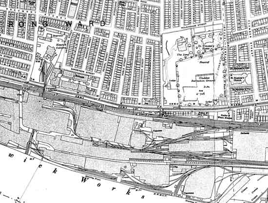
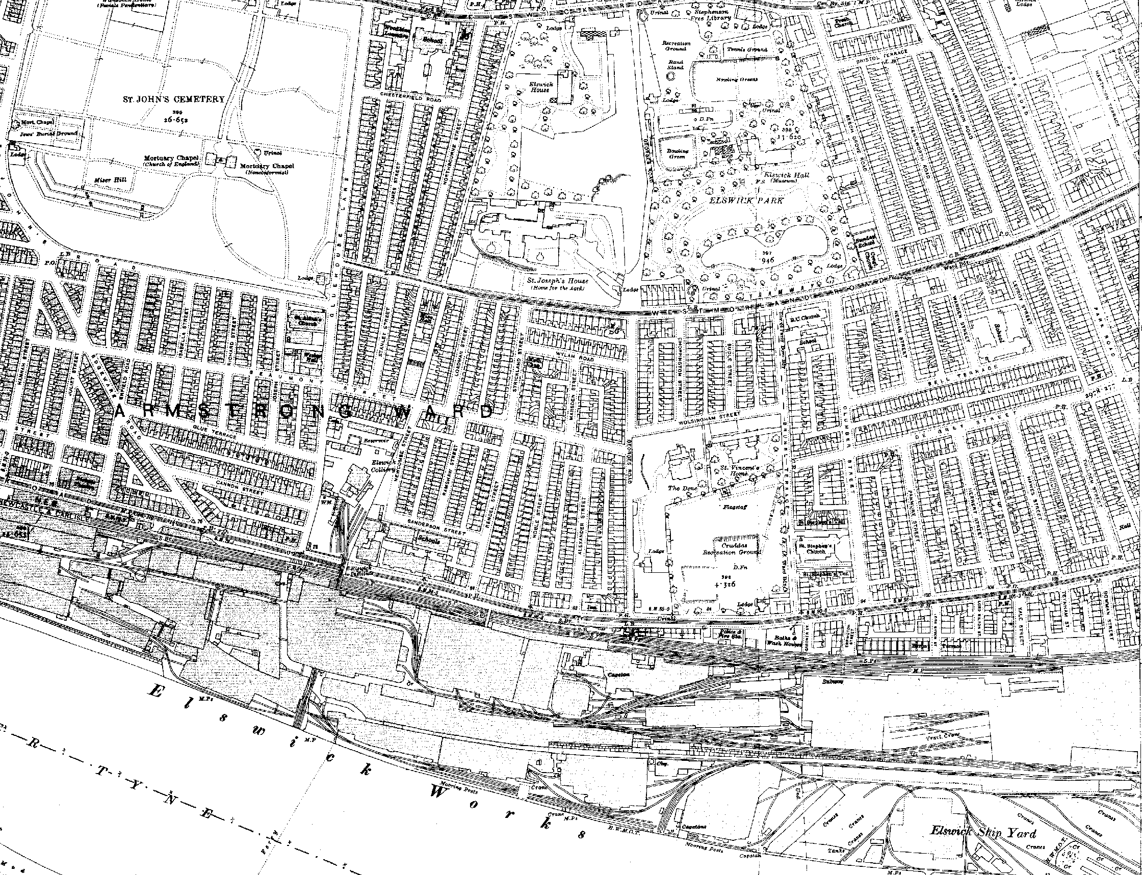
Below is an Ordnance Survey 1919 map of the area
showing the colliery and Elswick Works |
|
|
|
©1992 Newcastle upon Tyne City Libraries |
|
|
|
|
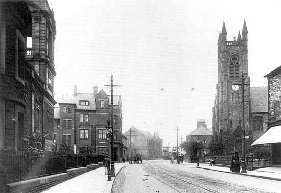
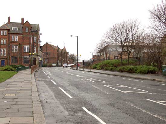
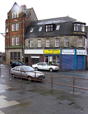
Above are three views of Elswick Road, at the centre of the village of Elswick. First, an Edwardian glimpse of trams
and churches. On the left is the John Knox Presbyterian, and on the opposite side is the Wesleyian Methodist. Lloyd's Bank is on the corner of Beech Grove Road, and further along on the same side is the
Stephenson Library.
Below that is the scene today. The churches were gone by the 1980s. The lowest shows the scene from the opposite direction. That bus shelter marks Meldon Street, and is where those
trams are passing in the earlier picture.
Pictured right is the bank and a few of the surviving shops. Elswick Road used to be a thriving shopping centre. The demolition frenzy of the 1970s put paid
to that. |
|
|
 |
|
|
|
|
©1975 City Repro |
|
|
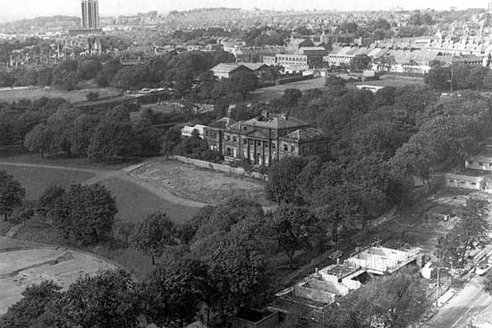
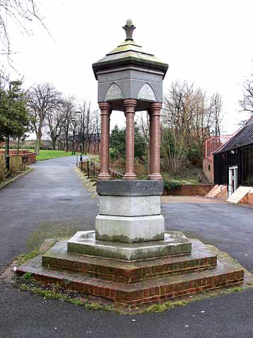
Elswick Hall was the site of a previous Priory, but the building pictured above in 1975 was put up in 1810 by John
Hodgson. Famous owners have included Richard Grainger, architect, Christian Alhusen, chemist, and William
H. Stephenson, industrialist and benefactor. In 1881 the grounds became Elswick Park. The fountain pictured here was erected to commemorate a group of men who bought tracts of land to prevent building
development and later transferred ownership to the City Council.
Those preserved in memory on this fountain are; Joseph Cowen, Thomas Forster, Thomas Gray, Thomas Hodgkin, William Smith, and William
H. Stephenson.
After a period of neglect the park was refurbished and reopened to the public in January 1981. |
|
 |
|
|
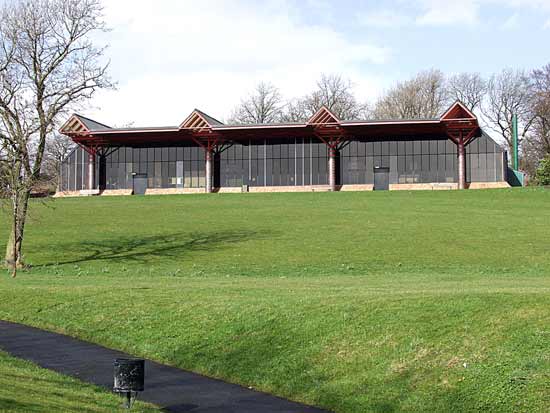
The Hall was replaced by this leisure pool, much used by the local people. Many are the happy hours I have spent splashing about
in there.
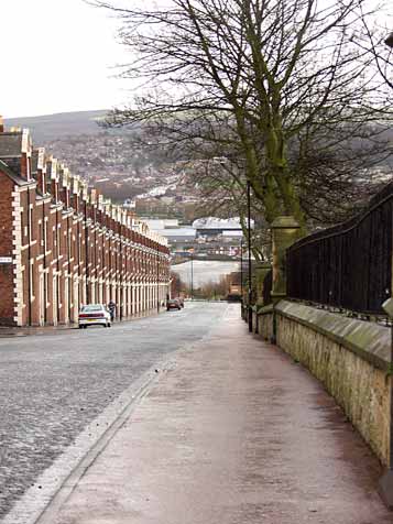
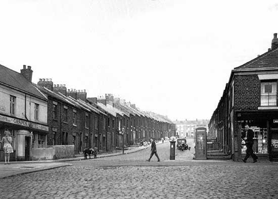
Below is the 1963 view of Hawes Street at its junction with Scotswood Road. De Grey Street is visible at the top, and the Post Office and The Grapes Hotel were much used facilities. Below is the same
view today. |
|
|
|
©1963 Jimmy Forsyth/West Newcastle Loacal Studies Group |
|
|
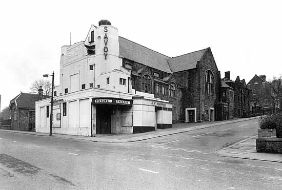
The Savoy cinema opened in 1932, being converted from Beech Grove Congregational Church. This is one of several cinemas in
Newcastle whose interior design and decoration was my father's work when he was a partner in Fred Foster's of Nottingham. It suffered storm damage in 1965 and a fire in 1966 causing closure until 1969 when it was
reopened as a bingo hall. It finally closed in 1988 and was demolished in 1993. The site remains unused to this day. |
|
|
|
©1968 Newcastle upon Tyne Libraries |
|
|
|
|
|
Elswick's reliance on heavy manufacturing had grave implications for this once thriving community. The
inter war depression saw the large Victorian houses fall into multiple occupancy, and munitions manufacture was turned to cycle and light engineering. I owned an Elswick Hopper cycle in far away Manchester
in the 1950s.
By 1964 the white heat of post war "slum" clearance meant that the community was dispersed. The 1980s saw the demolition of Elswick works; its once 78,000 strong workforce reduced to a
mere 700.
New high-tech business parks now occupy part of the site and a new Industry Park is being constructed to the north of Scotswood Road.
The economy of the area may be budding, but the
community has long gone. |
|
|
|
|
Site and contents (unless otherwise stated) © Tim. Pickford-Jones and Timmonet, Newcastle upon Tyne,
United Kingdom. |
|
|
|
|
 |
|
If you should arrive here via a search, or be missing the navigation on the left hand side, click this button.
|
|

